What is Lone Peak Wilderness?
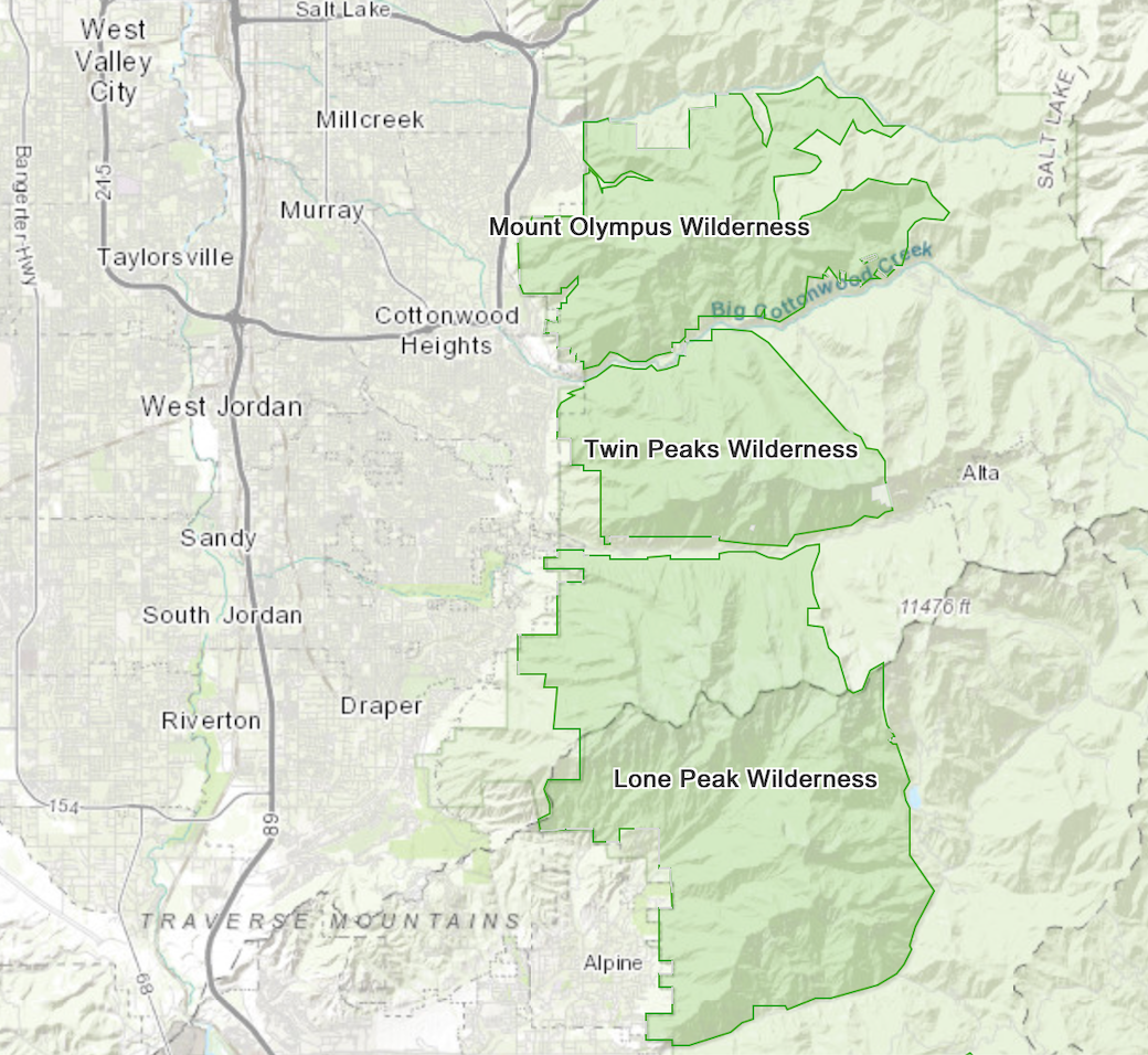
Lone Peak Wilderness consists of 30,735 acre in the Central Wasatch Mountains, located southeast of Salt Lake City. This wilderness area was designated in 1978 by the Endangered American Wilderness Act. This was the only established wilderness in Utah until the Utah Wilderness Act was passed in 1984.
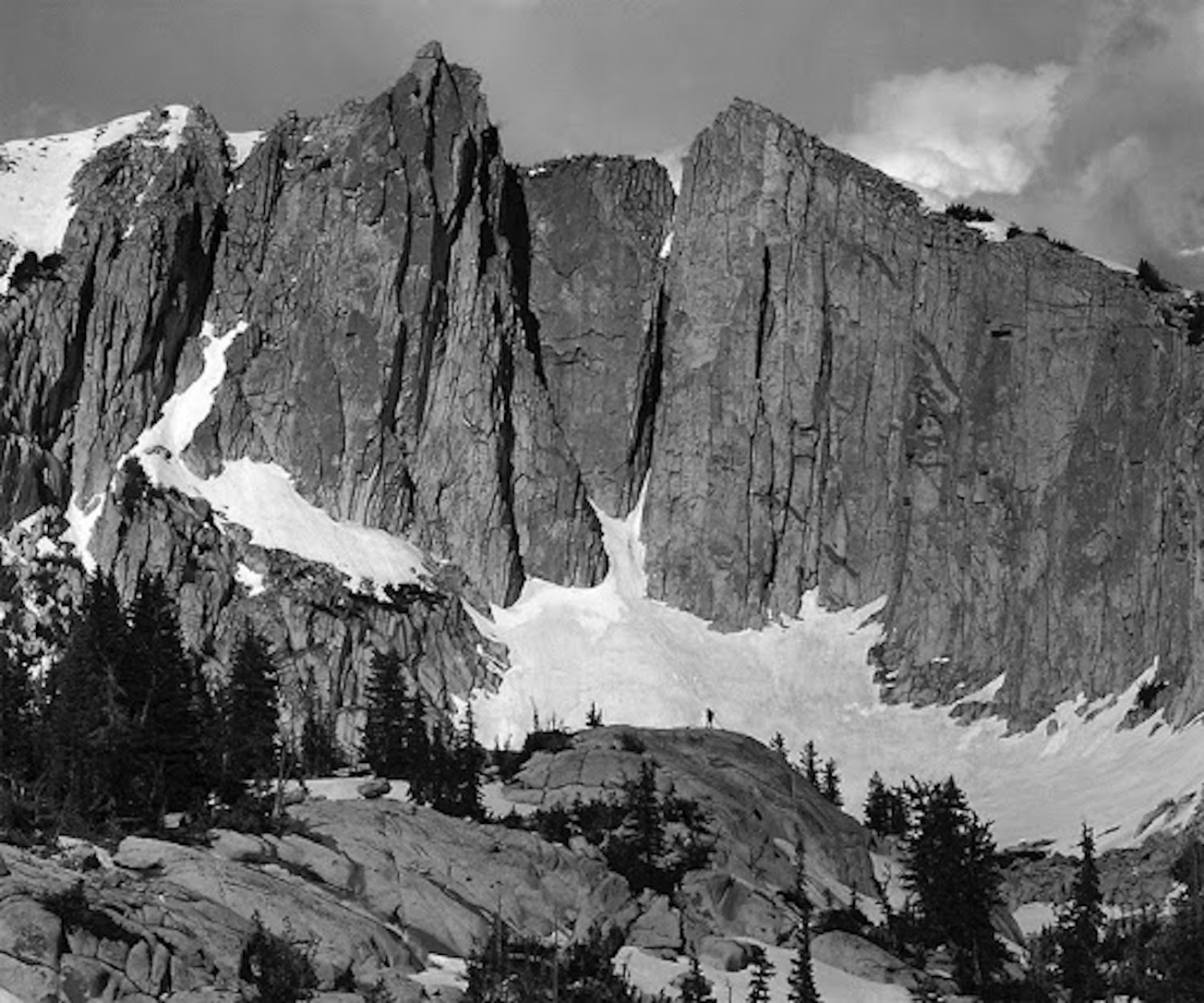
Lone Peak Wilderness Area goes as far north as Little Cottonwood Canyon and south to American Fork Canyon. Its elevation ranges from 5,500 to 11,326 feet. The two highest and notable peaks in this area are Lone Peak at 11,253 feet and Little Matterhorn at 11,326 feet.
For more information about Wilderness areas:
https://www.nps.gov/subjects/wilderness/index.htm
https://www.blm.gov/programs/national-conservation-lands/wilderness
https://www.fs.fed.us/managing-land/wilderness
Geology:
Lone Peak Wilderness allows recreationists to escape the hustle and bustle of the Salt Lake Valley by only traveling minutes to this area. It is known for its high rigid peaks that reach over 11,000 feet, as well as narrow valleys, open basins, and rigorous terrain. Its geological features consist of sedimentary formations, masses of granitoid rock, and glacial topography. Currently, erosion is the strongest force sculpting the land in this area. Small lakes and streams are found in a few areas throughout Lone Peak Wilderness.